

Precision agriculture – what is it and what’s out there
Precision agriculture refers to the use of technology that helps farmers to manage their fields in a more precise and accurate manner. These technologies include:
- Precision agriculture technology to predict and monitor crop yields.
- Sensors that can measure a variety of field parameters.
- Remote sensing, such as satellite imagery data to detect problems in the field and monitor field performance.
- Decision support software tools.
- Robotics – precision application of inputs, such as fertilizers, pesticides and seeds.
Until recently, there was a distinction between smart farming and precision agriculture. While smart farming encompassed all the above technologies, precision agriculture referred to technologies that allow to divide large fields to “management zones”, based on the variations in the field, and manage each zone individually, rather than refer to the whole field as one uniform unit.
Soil mapping and GPS guidance currently have the highest adoption rate, (exceeding 80% in the large farms). Tther technologies have a lower, but continuously increasing, adoption rate.
Yield monitors and yield map
Yield monitors are one of the first precision agriculture tools that were introduced. They allow the combine harvester to collect real-time data on the amount of yield harvested and other related parameters, such as grain moisture. The yield monitor also includes a GPS receiver, which records the physical location, along with the yield data.
The information can be displayed on a map, referred to as “yield map”. This helps the farmer in many ways. For example, he can relate yield variations in the field to other factors that can affect the yield, such as variation in soil, application of inputs, irrigation etc.
In-field sensors are widely used in precision agriculture
Most precision agriculture technologies use sensors. This includes the yield monitor, GPS data, satellite data, sensors mounted on drones etc. Some sensors can be placed in the field at monitoring stations. These sensors measure the plant’s immediate surroundings as it grows. For example:
Soil moisture sensors measure the moisture content of the soil, enabling farmers to make smart irrigation management decisions. Instruments for measuring soil moisture have been out there for many years. Methods for measuring soil moisture have seen recent improvements. These advancements enable measurement at various depths, ease installation, and offer continuous data transmission to apps or computer software.
Another type of soil sensor is soil electrical conductivity sensor. These are sometimes combined with the soil moisture sensor, as both parameters are related.
The readings of the soil electrical conductivity can be used for salinity estimation, and therefore help farmers with fertilization and irrigation management.
Nitrogen level in soil can also be measured, using nitrogen probes. However, since nitrogen reactions in soil are complex, such readings are not sufficiently reliable for nitrogen fertilizer management.
Other sensors include soil temperature sensors, soil pH, air temperature and humidity.
Some other types of sensors are mounted on the leaves and stem of the plant, providing valuable data on the plant’s status, such as water uptake and water stress. New technology, using very thin graphene-based sensor will allow to “tattoo” the sensors on the plant’s leaves.
This entire set of data enables the farmer to make much better decisions about his field and crop.
Drawbacks of in-field sensors
The major drawback of sensors placed in the field is that they provide information on a specific place within field and on a small number of plants. Therefore, the location where the sensors are placed must represent the section of the field that the farmer would like to monitor. If the variability in the field is high, more sensors are needed, which can become costly.
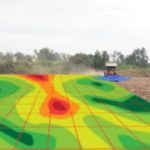
Use of remote sensing in precision agriculture
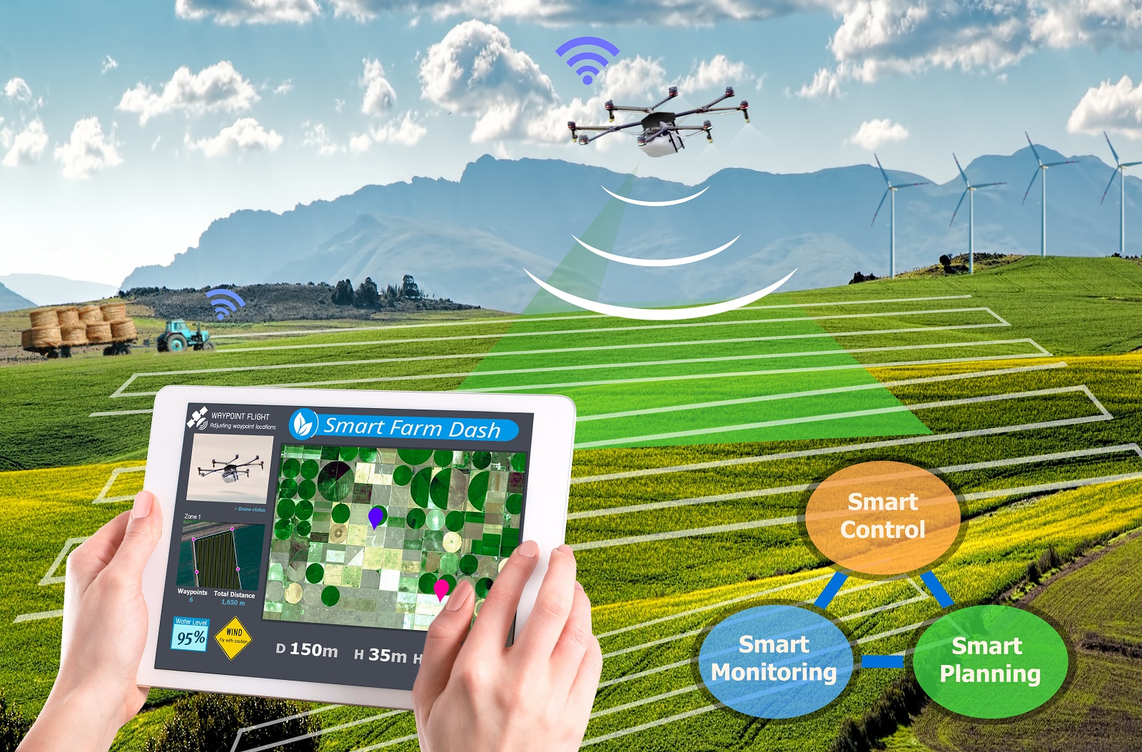
Data from satellites and drones provide an additional dimension of the field, that was rarely considered before – a view from above. This is a unique and important aspect of precision agriculture. It enables farmers to detect problems, which were very difficult to detect before this technology became available. Drones and satellites can provide information on pests and diseases, the nutritional status of the crop, help in yield prediction and more.
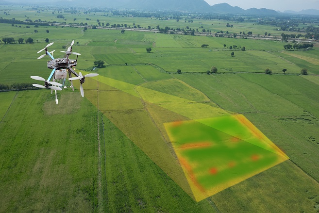
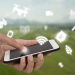
Use of drones in precision agriculture
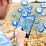
Decision-support software
Data should be analyzed and transformed into actionable insights or practical recommendations. This is done using decision-support software tools. Various computer software and apps were developed in recent years. However, since proven results may take longer to achieve, adoption rate by farmers is still relatively low. This aspect of precision agriculture is expected to rapidly develop in the next few years.
Variable rate technology and use of robots
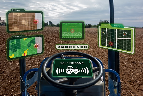
The other aspect of precision agriculture is being able to apply precise rates of inputs, based on data received from the sensing devices and on variability in the field. Each sector of the field gets a different treatment – seeds can be placed at different spacing according to soil type, specific fertilizer rates can be applied to each sector, pesticides can be accurately applied only where they are needed etc. Today, farmers who adopted precision agriculture technologies, use automated machinery, drones and robots to do tasks that were done manually or mechanically before.
What´s next in precision agriculture
Precision agriculture technologies can be categorized into three groups:
- Technologies that measure and collect data.
- Decision support software platforms and apps.
- Precision application of inputs.
Because of the relative infancy of precision agriculture, most existing technologies focus on one single aspect, which provides a solution to one of the many steps in the production cycle. In order to be fully adopted, various solutions must be integrated to form more comprehensive solutions.
The huge amount of data that is being collected and analyzed, supports research and the development of new technologies, and new insights are gained.
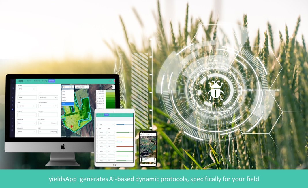
AI-Powered Agronomy
yieldsApp is a revolutionary agronomic platform that leverages cutting-edge technology to transform traditional farming practices into more efficient, data-driven, and sustainable agricultural methods.
The platform is designed to assist farmers, agricultural consultants, and agribusinesses in optimizing crop production while minimizing improving soil health, reducing agrochemical usage, and promoting sustainability. Click here to learn more about the technology.